

Leg Descriptions
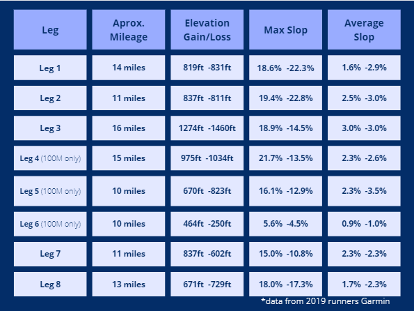

QUICK OVERVIEW
MORE DETAILED
The following descriptions were put together from a few different runners' descriptions of the 2020 trail. There may be minor changes to the course.
Leg 1 – St Paul to Edourdville - approx. 20 km (You name it you probably will run though it)
Starting in town, feed off the energy of the rest of the field and get a nice tour of the community. It feels like you met up with your local running group. Settle into your rhythm as you run through town but keep an eye out for the flags; they can be easily missed planted beside the footpath.
Good to practice looking ahead scanning for flags as it's a necessary skill through the whole run. Don't worry; the course is well marked, so long as you are aware of your surroundings. The wooden walkway feels like you're at the beach. After the lap of town, we turn east onto the Iron Horse Trail, and there is always a crowd cheering as we hit the trail for the first time, and it continues to be a nice easy run. Remember, trains don't go uphill unless they really need to, so every time we're on the Iron Horse, it is pretty flat.
When you depart the trail, it's the first part of the race where we get to run through some fields, keep watching for flags, and if you find one knocked, overtake a few seconds to put it back in the ground, your fellow runners will appreciate it. The views from the ridge are spectacular, especially if the leaves are still holding their Fall colours. There are some challenging climbs in this section, nothing really long but steep enough and some opportunities for wet feet but pay attention, and you should stay dry. When we drop back down beside the Iron Horse (though still in the trees), it's often slow going as the grass can be high, some fallen timber to negotiate, and depending on the year, the cattle may have made it a bit rough. An enjoyable leg of the race, and you're guaranteed to have some company worth the work as you can get a cookie.
Leg 2 – Edourdville to Moose Mountain - approx. 17 km (A relatively short leg with plenty of gravel road, and most likely cows)
Leaving the aid station, it's a solid hike; the first bit of trail is sometimes runnable but often better to hike it, uphill on a washed-out trail, easy to roll an ankle if not paying attention. Through a yard, and shortly after, we drop into another field.
Plenty of runnable sections, a few fences to cross, and some beautiful scenery in this section, part of this section take us down a track with trees close on either side. No effort is required. Just roll down the hill with the sound of leaves crunching underfoot.
Eventually, we go through a farmyard, turn south for a short stretch, and head east on the gravel. It's gently rolling, runnable, and once we turn east, it is 5 miles (8km) to the end of the leg.
Find company to get through this life-sucking, inclined gravel road. Pays to be alert for cars as there are plenty of crews back and forth looking for their runner – always run towards traffic. Right at the end, you will cross a highway, so aware of the trucks, and they do not stop for you.
Leg 3 – Moose Mountain to Elk Point - approx. 25 km (Mean Deans Hill, its not a mountain and there is more to it than just a hill.)
Before starting this leg, make sure your hydration is full, there's a remote water drop, but it's a way to go before that point. 26km is likely going to take over 3 hours and the day also starts to heat up by this point (unless it's a cold, wet year, which can make it equally tough).
A few km through a field eventually coming out across an oil lease onto a gravel road. Head east on the gravel and then north. Look to the horizon, and you can see what is ahead - about a mile downhill on the gravel, but once we cross the pavement at the bottom of the valley, you will approach Mean Dean's Hill.
The hill is a mile and a half of steep climbing with the odd dip. Prep yourself for a steady climb, and if you are tempted to run the short downhill sections, really watch your footing, not a place to roll an ankle. Take a second to look back, some spectacular views to the south. At the top of the hill, it's worth celebrating, but it isn't over yet; heading east, there is a mile of steep rolling hills before we reach a road. And what a road it is, close to 2 miles of steady downhill running, give in to gravity and let the legs rollover. Eventually, we'll cross the pavement again, get into another field, and have some pleasant running down to Moosehills Lake.
There are a few sections along the lake where a quick hike is easier than running as we follow cow trails through the brush and then shortly before we get back on the gravel, we get to top up our water bottles at the remote water drop.
Back on the road, it's downhill on some rough pavement around a bend and then a bit of a climb (still following the road) until we get to the Iron Horse Trail again when we hit the Iron Horse its about 4 ½ miles into Elk Point and the third aid station.
You hurt. You doubt humanity ever existed. You doubt you're on the course anymore. You'll hate your life. But do not quit. 100k runners, you are well on your way. 100milers, still 60miles to go.
Leg 4 – Elk Point to Fort George - approx. 24 km (just get this one done. (For 100milers only))
Heading out of Elk Point (on the roughest part of the Iron Horse – it always has lots of gravel on this part of the trail), make sure you follow the signs, miss the turn, and you're only doing 100km.
After dropping into the valley, cross over the creek and wind through the trees beside the creek, a beautiful little section of the course, watch for the roots which will try and trip you. After a while, we exit the valley onto the edge of the golf course.
A bit of everything on this section, a stretch in the ditch beside the highway, always long grass that makes running difficult, but it doesn't last too long, and we cross over the highway into another field.
When we reach the road again, it's down towards the river and under the bridge, before we climb up and into a field where we run along the ridge – be sure to check out the view of the river. It's well-marked, but you have to keep your eyes up and scan the horizon as we're not always on an obvious path through this part. Keep your eyes up, but also watch for barbed wire on the ground when you are running beside old cattle fences.
When you reach the road, head south but be ready to climb the fence after a few hundred meters, it is flagged, yet more than once, I've seen a runner miss the turn (if you must run with music, one earbud is a good idea, or you may not hear a fellow runner yell out to you).
A few miles through fields, some runnable and some less than runnable hills. When we come to an oil lease road, it's half a mile north and 2 miles east along the gravel road – watch out for traffic there can be a bit on this road.
The last couple of miles take us into Fort George and over the halfway mark. If you haven't already got it with you, take your headlamp and have something warm to put on your head, the sun may still be high in the sky, but it will almost definitely be dark by the time you finish the next leg: a great leg, huge variety of terrain and some breathtaking scenery.
Leg 5 – Fort George to Lindbergh - approx. 16 km (River bank, gravel and the Iron Horse trail. (For 100 milers only))
Don't expect a fast start to this leg; it's short, but the first bit is slow. Dropping right down beside the river, it's a beautiful spot just not made for running, soft muddy riverbank which is tough to do anything other than hike on.
When we come up out of the valley, it's through a field; pay attention for holes when running beside the oil lease; some critters have dug a few that always surprise me and would be easy to trip or worse.
When we get onto the gravel, it is time to run, and this is where this leg can be quick. Half a mile mostly downhill, and then we turn right and head east for 3 miles towards the salt plant.
A sharp left, and we continue following the road before taking a left onto the Iron Horse Trail. Only about a mile and a half to Lindbergh. You'll see the aid station lights ahead but don't get excited just yet, and we have a small tour through town to complete first.
A few hundred meters before the aid station, we take a right, crossing over the highway and heading uphill on the paved road at the top of the hill; there are some dumpsters where we take a left and get onto a nice little trail that brings us out beside a house.
Once in Lindbergh, it's a short run into the aid station. If you're not dressed warmly yet, do a quick check. The next leg may be short and flat, but I find it the loneliest leg of the race.
Leg 6 – Lindbergh to Elk Point - approx. 18 km (No flags needed, stay on the Iron Horse. (For 100 milers only))
18km of nothing but the Iron Horse Trail, so don't worry if you don't see a flag, keep heading west, and you can't get lost.
This leg is lonely, it's dark, there are trees on either side giving a closed-in feeling, and while it's flat, there are a few spots where water has settled, so there are puddles and dips that can get into your head. It may all be the Iron Horse Trail, but the trail itself is generally hard-packed dirt on this section, nice footing, and you don't have to worry too much about picking up gravel in your shoes. For sure, it can all be run, but we're past the 100km mark, and sometimes it just feels good to walk for a minute.
It is tough to judge the distance you've covered, it's not long, but this one does seem to go on forever. A bit over halfway through this leg, we meet the point where we hit the Iron Horse during leg three, and from here, it is about 4 ½ miles to Elk Point.
When you pass the Muriel outhouse, it's down to 3 miles. Seeing Elk Point at the end of leg 6 is such a relief. Warning: as nice as the volunteers and Elk Point aid station are, don't get too comfortable.
A few runners get comfortable by the fire and then find it extra difficult to get going again, particularly when the night is getting colder. Eat, drink, replenish your pack and make sure you've got warm clothes on; get up and get going. There is only a marathon to go.
Leg 7 – Elk Point to Happy Hill - approx. 18 km (look up this you are only on of a few people who get this view (technically leg 4 for 100 km runners))
Three and a half miles of the worst stretch of the Iron Horse Trail, but this section seems to have more gravel and bigger gravel than any other section of the trail, but it doesn't last for too long. Usually, a fair bit of hiking and swearing until you get off the trail.
We turn off onto a road over a bridge around a bend and then head south for about half a mile. Watch for the flags here and head west. Once heading west on the road, it is three miles, starts as a maintained road, rolling hills, and eventually becomes a track, still passable with a vehicle but certainly not a well-used road.
Almost guaranteed to hear coyotes howling back and forth, and if the conditions are right, we'll see the Northern Lights. When the road runs out, it is into the trees, and this section varies from year to year depending upon how active the beavers have been damming up the creek. This is a pretty part of the course, but only the 100km runners see it in daylight.
If you are running through here in the dark, an extra headlight or flashlight is handy, or pair up with another runner. This section through the field is probably the toughest to navigate. It is flagged well but, we don't necessarily follow a natural path, and the terrain is up and down, so some time is spent scanning ahead for the next flag (the flags have reflectors, so they are visible).
Going through the field always seems to drag on, but eventually, we are at the bottom of a hill, and the bright lights of the Happy Hill aid station are ahead. If we are lucky, we reach Happy Hill with dry feet and a happy heart. It's all business at the aid station, it's been a long day, and everyone is tired, and it's usually cold. Beware the tent, it is the hottest place on Earth, and it is so inviting.
Leg 8 – Happy Hill to Reunion Station St. Paul - approx. 20 km (The run home. (technically leg 5 for 100km runners))
Three and a half miles along the gravel road, rolling hills that seem steeper than they are, and a bit of traffic. Crews going to and from Happy Hill have to travel this road, so there can be more traffic than you'd expect, especially in the early hours of the morning. Oh yeah, and maybe large farm equipment. On one crossroads, there is a farmyard with some dogs, they always bark and come up to the fence, but I've never had them go beyond the fence, just keep shuffling past.
The road starts to wind downward, and this is a place where a quick mile can be peeled off. So long as gravity is stronger than the mind and allows the legs to keep rolling over, the distance passes quickly. We come upon a very well-marked turnoff directing us onto an old logging trail amongst the trees.
Not lots of running as we have to pick our way along, around fallen trees, over the odd log, and continually looking for the next flag. At the end, we'll climb a fence and be back on the Iron Horse. The trail is in good shape, but it's just another part where it seems longer than it is, only a couple of km, but I always think I should've already reached the turnoff and start worrying that I missed it. You can't miss it; right after one of the sets of cattle gates, we climb the fence and embark on the final climb. It isn't a long hill, but it is steep, and if it's wet, it is extra fun; at the top, we follow the power poles until we come to the end of the road.
Navigating from here is simple, continue straight on the road for about 5 miles, and we're almost done. It's a slow 5 miles with some rolling hills but remember every crossroad represents another mile completed. After we crossed the paved highway, it is another mile to the turn. The lights of St Paul should be clearly visible now (unless it's foggy).
Once again, you doubt if humanity exists, but then we turn it's a nice easy run (or more likely walk-run) to the finish. After the white building on the left, it is the same road that we ran some 90 plus miles earlier, past Sobeys, over the highway at the lights, and past St Paul Dodge.
Turn west on the Iron Horse and soak in all the emotion. Go through the gates and make sure you are running by the time your feet hit the grass. You've just completed the Iron Horse Ultra. You are amazing. Don't forget to thank the volunteers. And pizza or hot soup!
(Thank you, A. French and R Helman for letting us combine your descriptions)